Services
Adtech Surveying Inc. is authorized to offer survey services by a Certificate of Authorization issued by the South Carolina Board of Engineers and Land Surveyors. As a licensee of the State of South Carolina, our work is performed in accordance with the requirements of The Minimum Standards Manual for the Practice of Land Surveying in South Carolina. Our team is highly skilled, experienced, and knowledgeable in their science.
Boundary Retracement Survey
The most common type of survey is a Boundary Retracement Survey. This can be made to locate existing property monuments or to replace “Lost” corners with respect to existing legal evidence. The client, as an option, may choose the have the lines between corners identified on the ground.
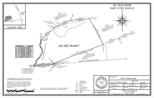
Click the survey image above to see the full example PDF.
Loan Closing Survey
A Loan Closing Survey is often required by a lender to define the property that they will hold as collateral for the loan and shows the location of any improvements on the subject property and identifies any encroachments or projection across property lines.
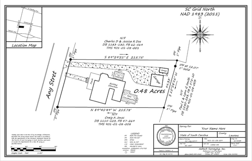
Click the survey image above to see the full example PDF.
Elevation Certificate
An Elevation Certificate may be required by the lender or insurer of your property to ascertain if it falls within a designated flood hazard area. The Elevation Certificate is an important administrative tool of the National Flood Insurance Program (NFIP). It is to be used to provide elevation information necessary to ensure compliance with community floodplain management ordinances, to determine the proper insurance premium rate, and to support a request for a Letter of Map Amendment (LOMA) or Letter of Map Revision based on fill (LOMR-F).
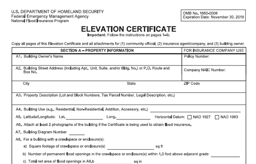
Click the survey image above to see the full example PDF.
Subdivision Survey
A Subdivision Survey is typically required when land is being divided into two or more parcels. This would provide legal descriptions of the parcels created as well as to ensure that they comply with local subdivision regulations and ordinances.
Topographic Survey
A Topographic Survey is usually required by architects or engineers for design and layout of buildings, storm water structures, streets and utilities.
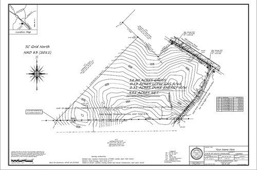
Click the survey image above to see the full example PDF.
ALTA/NSPS Land Title Survey
An ALTA/NSPS Land Title Survey is obtained when a loan is being secured on a parcel of property (usually commercial). These are the most extensive and costly surveys and are designed to provide comfort to the lender, the title company and the buyer as to title issues such as easements and encroachments, compliance with setback lines, zoning requirements as well as other other issues that may affect title to the property.
Construction Survey
Construction Surveys are layout surveys made prior to and during the construction progress to control elevation, horizontal position and dimensions and to determine the accuracy of the same upon completion.

Miscellanous Services
Often times surveys are performed to identify and/or to aid in the resolution of discrepancies that exist with respect to conflicting opinions or understandings as to the proper location of property lines. These require an investigation of legal documents, existing monumentation, parole evidence, long standing lines of occupancy and senior rights. Frequently the ultimate resolution lies in the hands of the courts.